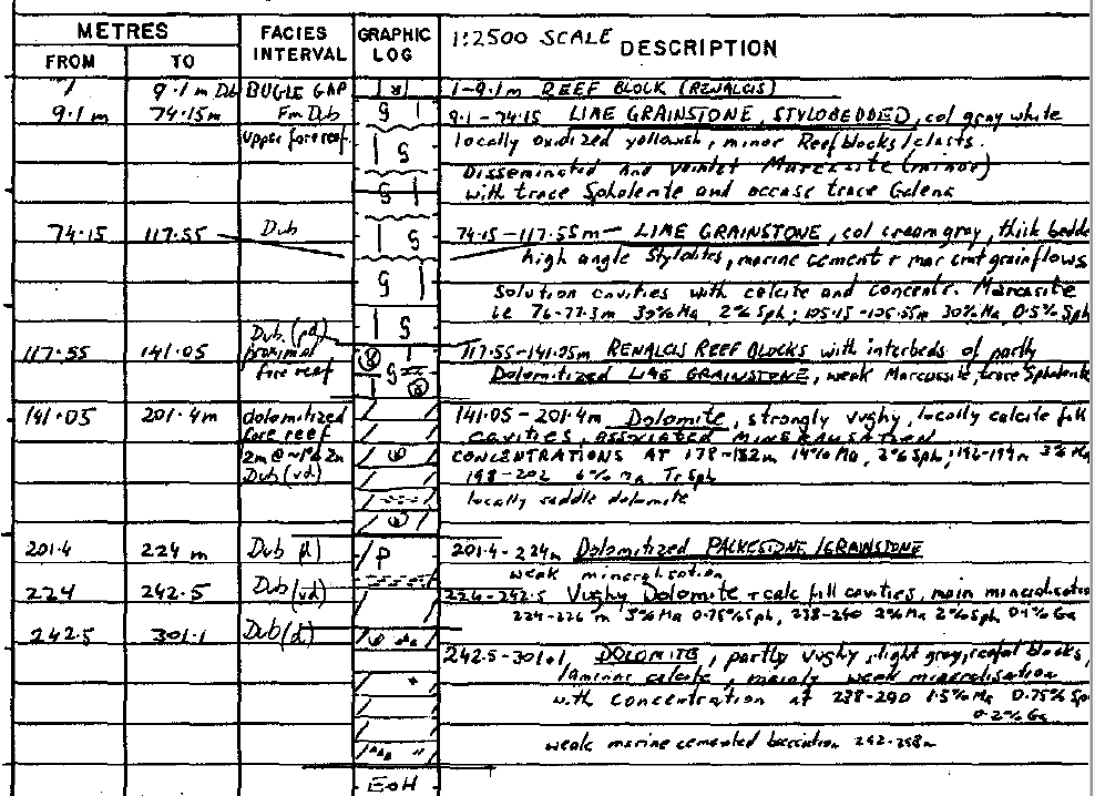
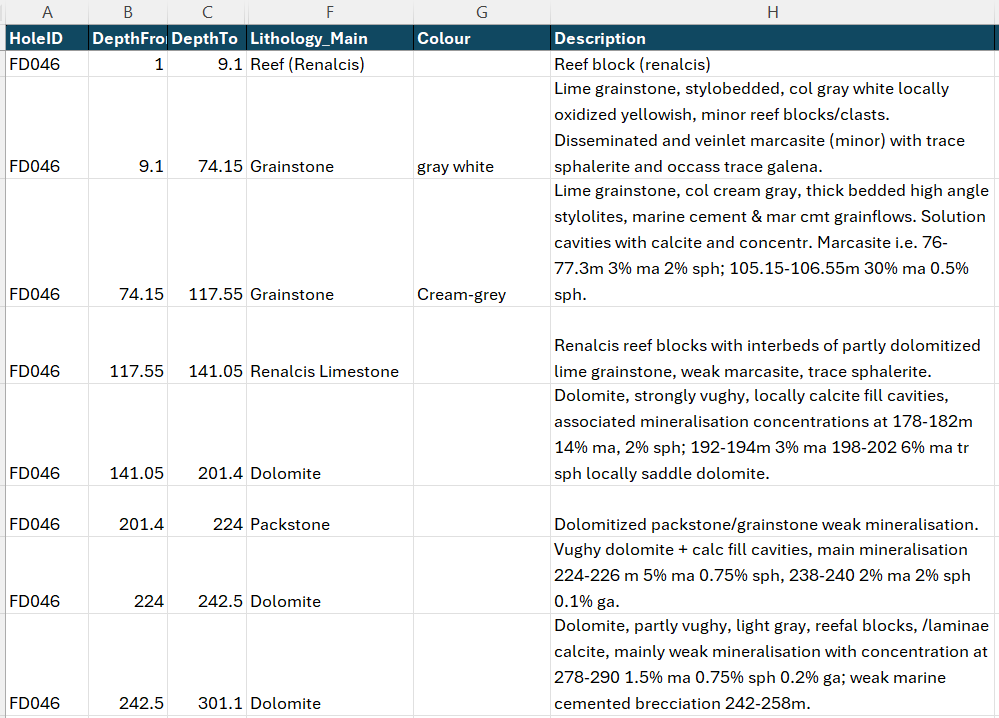
Handwritten field logs, structured for the database
Interval lithology and mineralisation data extracted from handwritten field logs into a structured, standardised database - with specialist review ensuring geological consistency throughout. Data templates are entirely flexible to client needs, so records drop straight into your existing drillhole database.
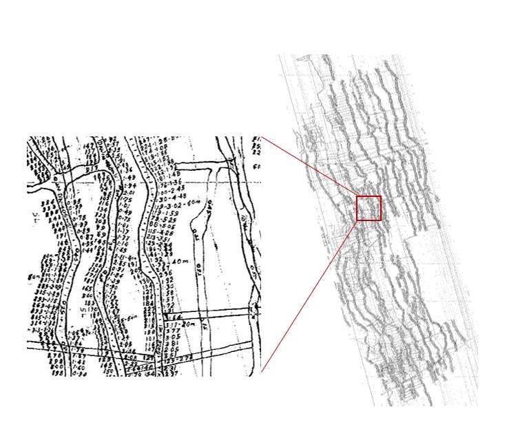
Underground mine channel sampling, recovered into 3D
Channel sample assay data captured from hand-annotated underground mine plans across multiple levels, georeferenced to mine survey control and loaded into a 3D viewing environment. Au-assay results that existed only as pencil annotations on paper are now navigable in three dimensions - visible, queryable, and ready for resource estimation workflows.
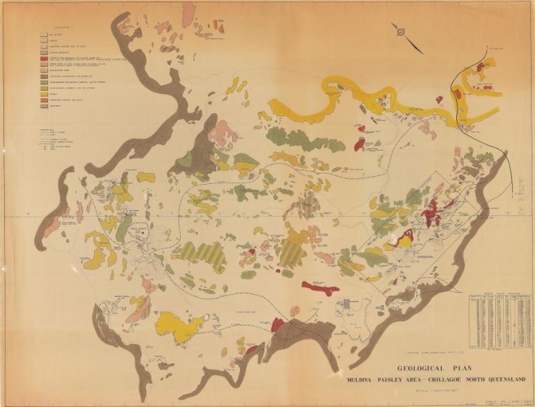
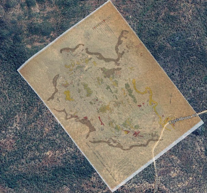
A geological plan with no coordinates, located with confidence
A 1970s geological plan carrying no coordinate data, georeferenced by matching drainage and topographic features to current satellite imagery. Positional confidence fully documented - so every polygon on the plan can be used, and defended, in a modern GIS.
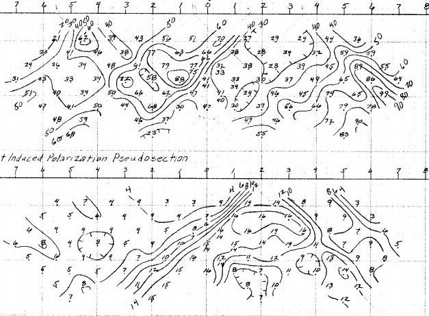
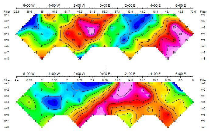
1970s IP pseudosections, made inversion-ready
Hand-drawn induced polarisation pseudosections from a 1970s survey - digitised, re-plotted and reformatted for modern 2D inversion modelling. Data that was uninterpretable in its original form is now inversion-ready, and a costly survey to reacquire is back in the targeting workflow.